Lesson 3: Doing more with Allmaps
Allmaps Viewer
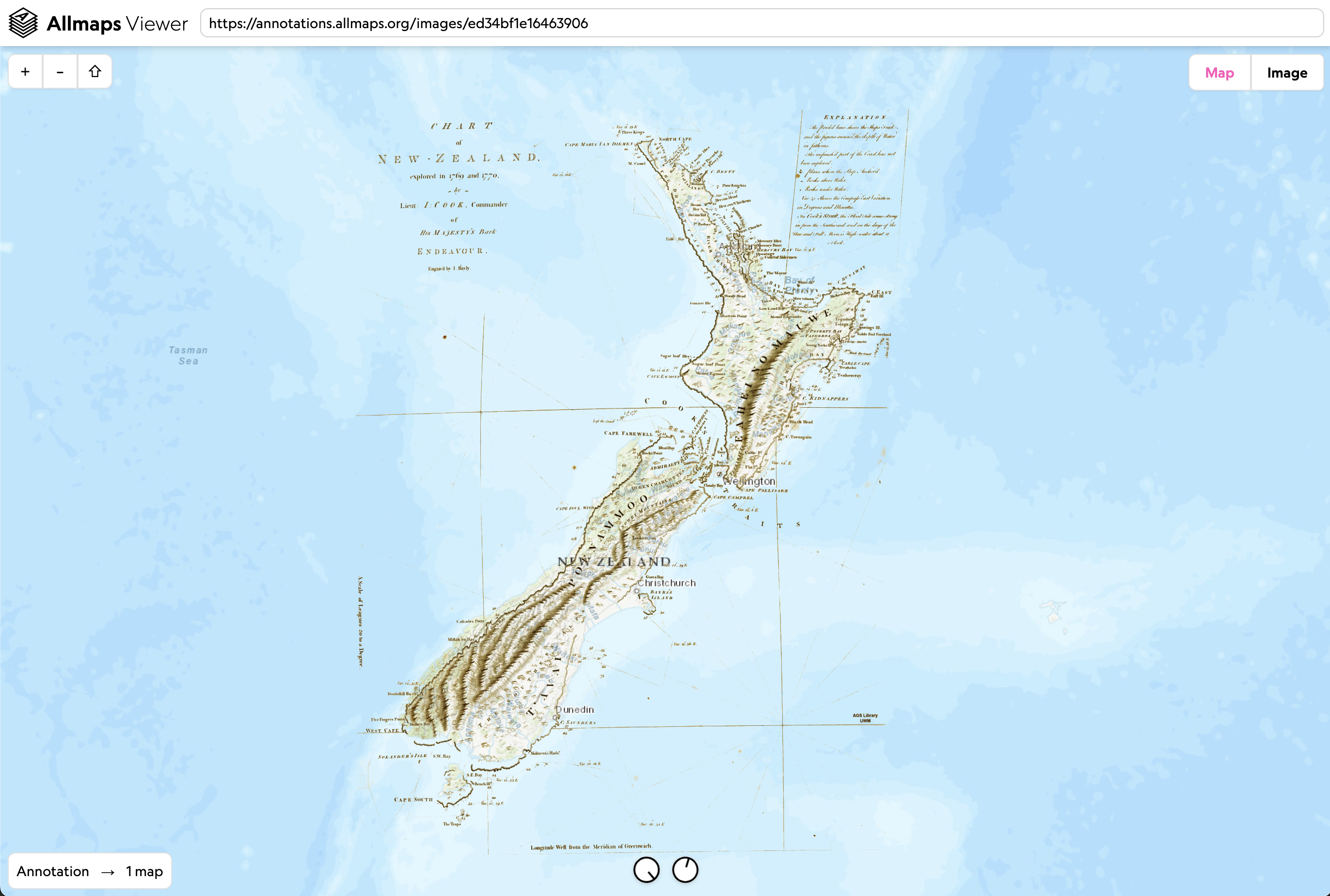
Allmaps Viewer is used to view georeferenced maps in Allmaps. Similar to the Results tab in the Editor, you can see the map overlaid on a web map. The Viewer also includes additional tools that let you customize the appearance and functionality of your map. Viewer is not used to georeference maps. Instead, it is used for inspecting results and assessing how a warped historical map behaves in relation to modern geography.
Common tools (found at the bottom of the screen) include sliders that control layer transparency/opacity and background removal.
Background removal is especially useful with historical maps. It removes the blank paper and helps isolate printed geographic content from the scanned page, making overlays easier to interpret.
Keyboard shortcuts:
- Space – Toggle transparency on/off
- B – Toggle background removal
- M – Toggle display of the mask line
- G – Display a grid over the image
- D – Cycle display of distortions: surface deformation, angle distortion, or none
Viewing Stitched Atlas Sheets
Take this example from the Milwaukee County land use and zoning atlas.
IIIF Manifest: https://collections.lib.uwm.edu/iiif/info/agdm/36112/manifest.json
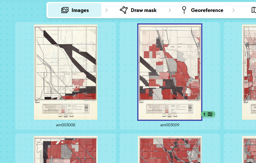
Green symbols indicate sheets that are already georeferenced:
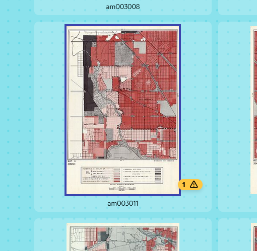
Yellow warning symbols indicate maps with masks but no georeferencing yet:
View this atlas in Allmaps Viewer to see how stitched maps are displayed. As more sheets are georeferenced, they’ll appear in the viewer.
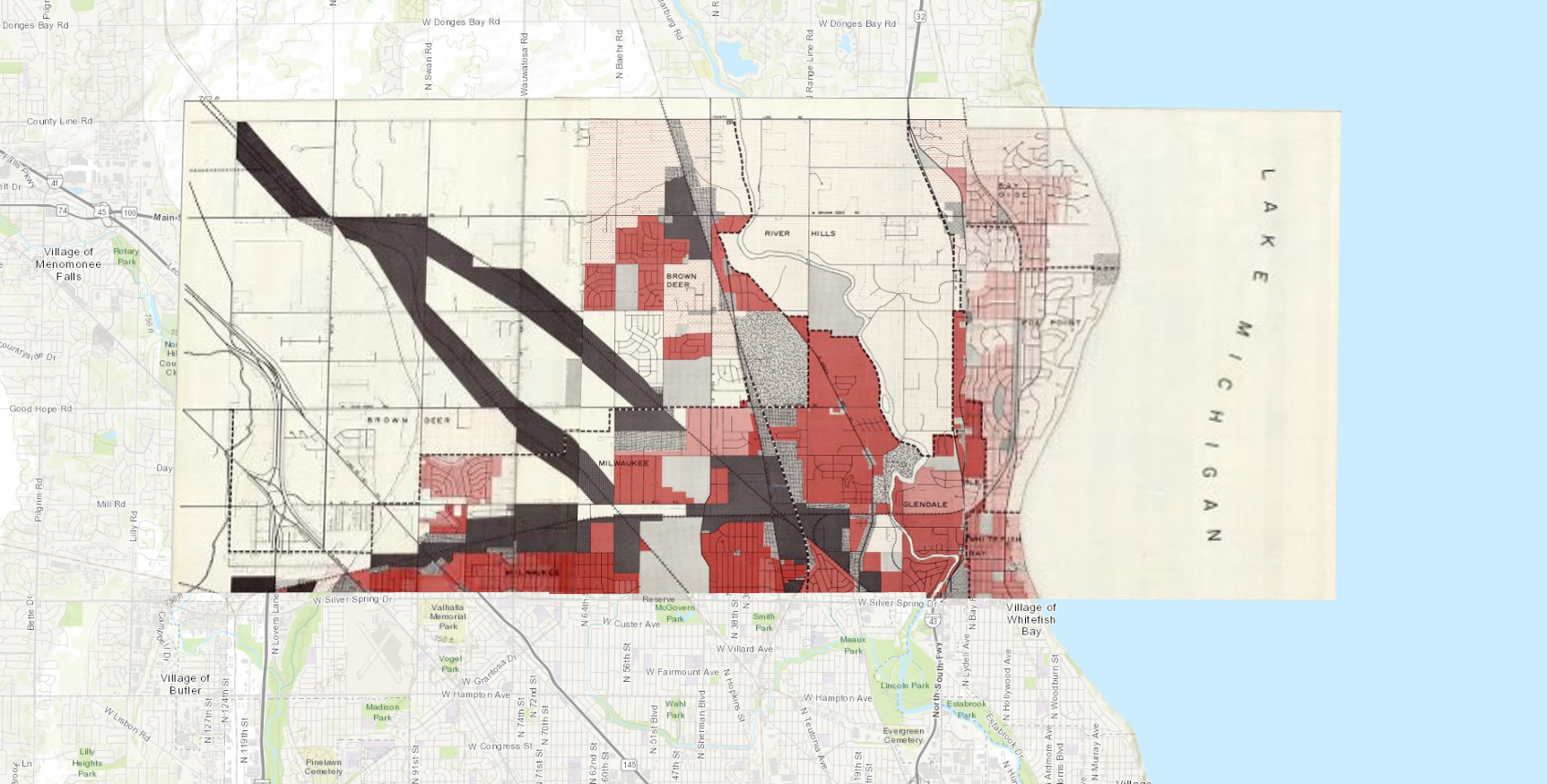
Since these atlas pages were carefully masked, they mosaic almost seamlessly, allowing you to explore the whole atlas at once. This kind of stitching takes careful work: small differences in mask placement or GCPs can create visible gaps or overlaps between sheets.
Using M to display the mask lines shows how all the component maps fit together.
When working with multi-sheet objects:
- [ and ] – Cycle through maps
- Open the map context menu, for example by right-clicking – Change map layer order
Using XYZ Tiles in GIS
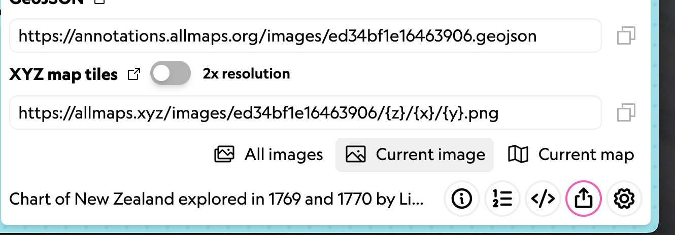
Allmaps provides a free XYZ tile server, allowing you to bring georeferenced maps directly into GIS software like QGIS. Note: this is not intended for permanent hosting.
In QGIS, use the Add XYZ Layer tool:
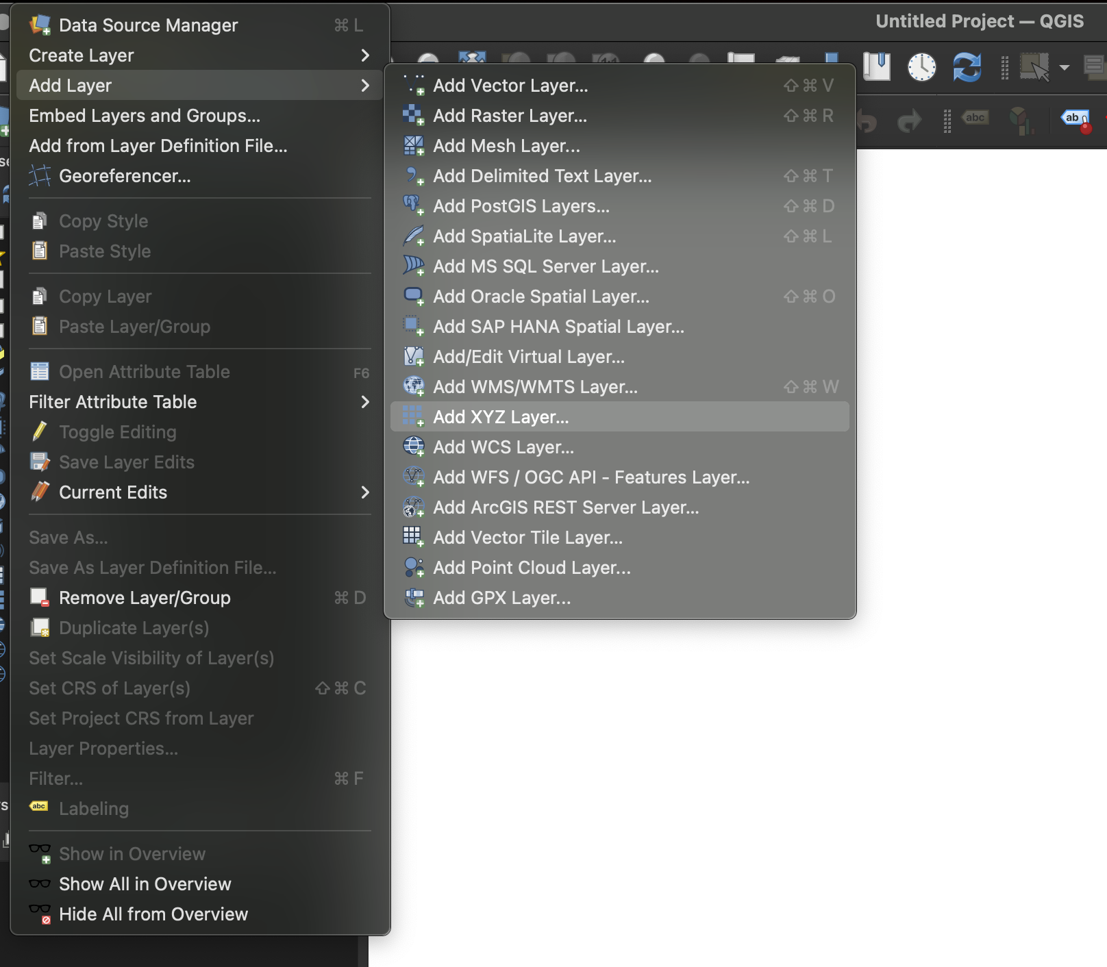
Copy the XYZ Tile URL from the Allmaps Editor Share tools:
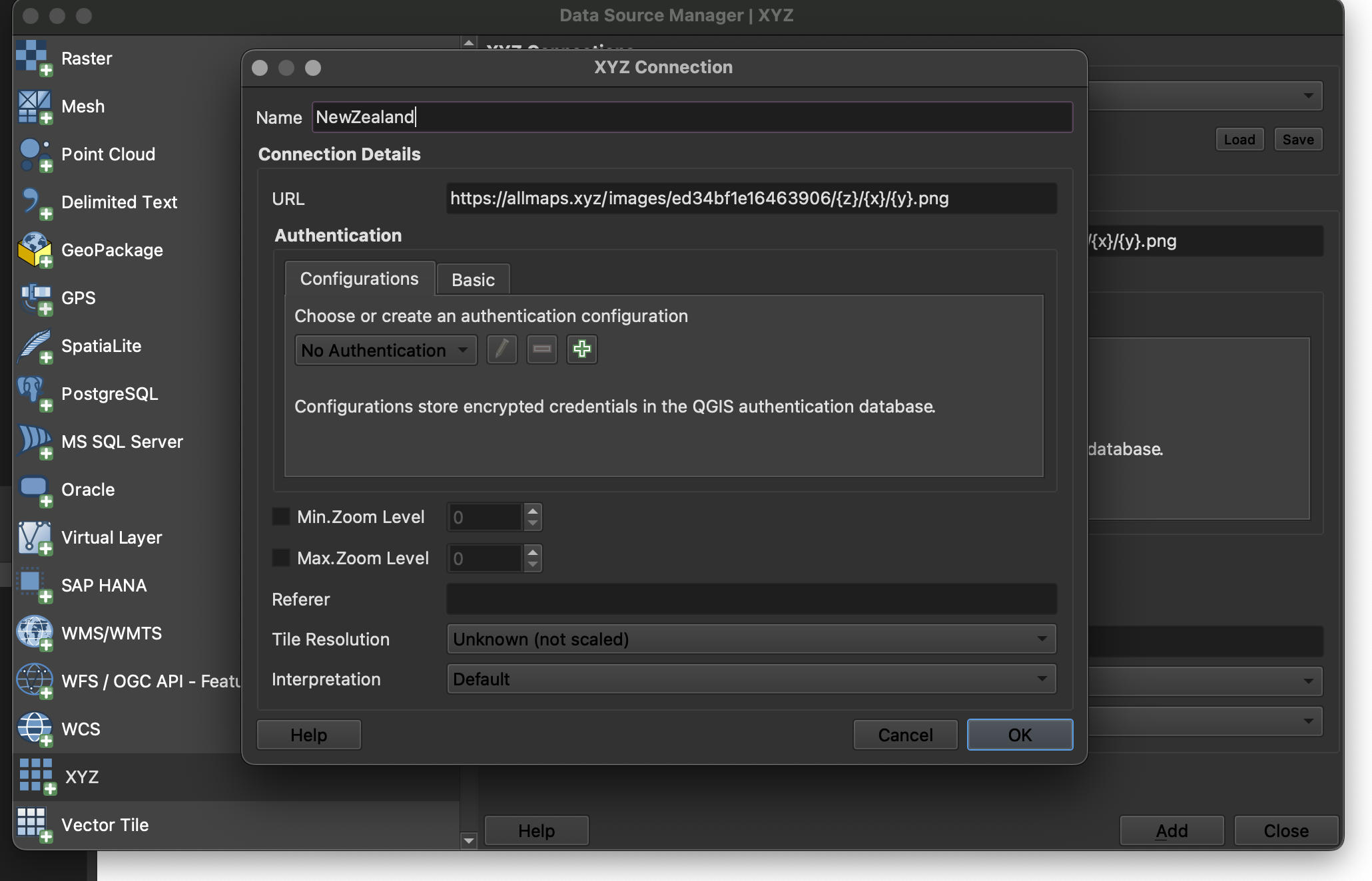
Then create a new XYZ Connection in QGIS and paste in the URL. No other changes are usually needed.
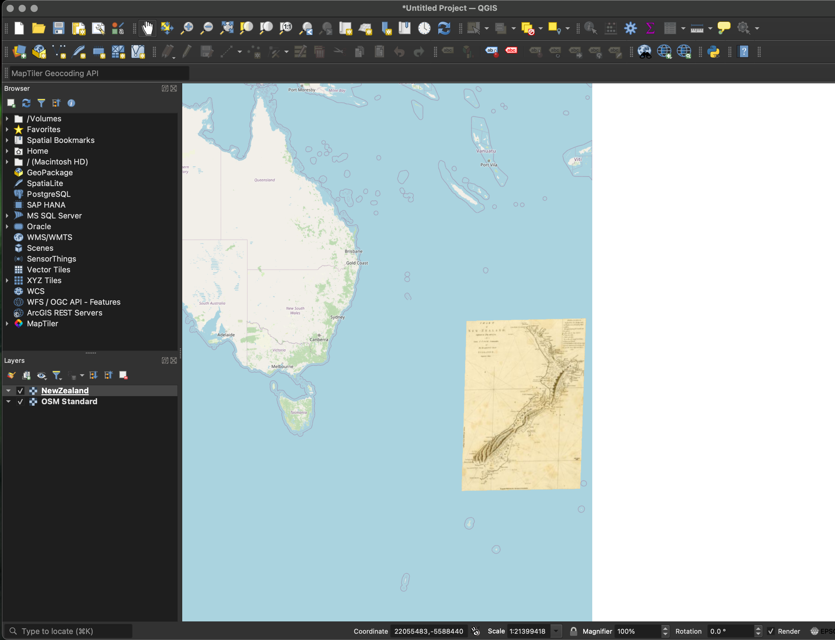
Now you can use your georeferenced map directly in desktop GIS!
You can even use the Export tool to save the result as a GeoTIFF, a standard format for georeferenced images.
Note:
Use the Allmaps Tile Server for testing desktop GIS workflows or other software that needs an XYZ tile URL. Because each requested tile has to be fetched, warped, and returned by a server, tiles may load slowly, break, or stop working.
For web maps you control, Allmaps Viewer or the Allmaps plugins for OpenLayers and Leaflet are usually better choices because they can warp IIIF images directly in the browser. This means the browser does the transformation work instead of depending on a tile server for every map tile.
More info on the Allmaps Tile Server is available in this Observable notebook.
More You Can Do
What will you do with your georeferenced maps?
Here are just a few exciting examples:
- Stories from Urban Atlases of Waltham
- Atlascope
- Architectural Drawings in Allmaps
- Georeferenced Aerial Photographs
To go even further, explore the collection of Allmaps Observable Notebooks:
- Use IIIF maps in MapLibre, Leaflet, or OpenLayers
- Draw vector GeoJSON layers on top of Allmaps
- Georeference based on toponyms (place names)
- Learn more about the code and architecture of Allmaps